

BELGIUM VIEW
1) Introduction.
2) Map and Flag.
3) Borders.
4) Regions.
5) Relief.
6) Climate.
1) INTRODUCTION:
Belgium is a Western European country, member of the European Union. If in French the country is called Belgium, it is also called België in Dutch and Belgien in German.
Capital: Brussels.
Population (2016): 11.348 million inhabitants.
Gross Domestic Product - GDP (2016): 466.366 billion dollars.
Official languages: Dutch, French, German.
Area: 30,528 km^2.
Currency: Euro.
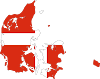
2) MAP AND FLAG:
 |
| BELGIUM MAP |
 |
| BELGIUM FLAG |
3) BORDERS:
Belgium is bounded on the north by the Netherlands and the North Sea, on the east by Germany and Luxembourg and on the south by France.
4) REGIONS:
Belgium is structured in 3 regions, which are themselves divided into provinces (except for the Brussels-Capital region).
The details of the regions and provinces are as follows:
Brussels-Capital Region: no province, 19 agglomeration municipalities.
Walloon Region: provinces Walloon Brabant, Hainaut, Liège, Luxembourg, Namur.
Flemish Region: Provinces Antwerp, Flemish Brabant, West Flanders, East Flanders, Limburg.
5) RELIEF:
In the south and south-east, Upper Belgium is made up of the Belgian part of the Ardennes massif. It is limited to the north by the coal furrow that connects the coalfields of northern France to the Ruhr. This depression is drained by the Sambre and the Meuse. Beyond, from the Scheldt to Limburg, stand the low silty limestone plateaux of Hainaut, Brabant and Cambresis. West of the Scheldt begins lower Belgium, the Flemish countries with clay and sandy plains that end on the coast by a string of dunes.
The Ardennes is an old massif with heavy and flattened forms, made of hard rocks (sandstone, shale) dating from the primary era. Its relief is characterized by high plateaus interspersed with deep valleys. At an average altitude of 460 m, this massif is covered with forests that pits the peaty depressions of Hautes-Fagnes where is the highest point of Belgium, signal Botrange (694 m). It is a rough and poor country, sparsely populated, where the only resources have long been the cultivation of rye and then potatoes.
To the south, the Belgian Lorraine, which belongs to the geographical area of the Paris Basin, is a region of cuestas where are practiced the breeding and the exploitation of the iron ore. To the north, the limit of the Ardennes highlands is marked by a depression called Famenne east of the Meuse, and Fagne to the west.
The furrow of the Sambre and the Meuse, dug in carboniferous grounds, is formed by a series of coal basins, which extend in the Borinage, from Charleroi to Liège, as well as plateaux with altitudes between 100 and 200 m . It is extended towards the west by the depression of Haine. This corridor, interrupted in the region of Namur, resumed in the valley of the Vesdre. North of the Vesdre, the country of Herve is a chalky and clay plateau, characterized by a landscape of groves. This hydrographic axis allowed the development of a real transport network and was at the origin of the industrial development of the region.
The average Belgium, in Hesbaye and Hainaut, is covered with a coat of loess which gives these regions their unity. Flanders and Campine form the lower Belgium where the altitude is never higher than 20 m, except for some hills and hills such as Mount Kemmel (151 m), Mont Saint-Aubert, Mount Enclus. The rivers trace their course through the alluvial valleys. Landscape is here a result of human work, inland Flanders having been cleared for centuries. The whole offers a typical landscape of grove dedicated to various cultures. The Campine, for its part, is naturally sterile: sandy and stony, it can only carry low-demanding crops.
On the edge of the North Sea, maritime Flanders is a narrow strip of sandy land that is never more than 20 km wide; sheltered from the dunes, it covers practically the whole coast to Antwerp and the country of Waas.
6) CLIMATE:
Belgium is exposed to the softening influences of the Atlantic and westerly winds. The temperate climate is mild and humid with slight thermal differences. Inland, away from moderating maritime influences.
The coastal area is formed by polders, protected by dikes and conquered on the sea. The interior of the land is occupied by pastures drained by canals. The altitude of the coastal plain never exceeds 20 m. The straight and flat coast is poor in sheltered port sites. Ostend and the other ports still threatened by silting remain only thanks to constant drainage.
Officially website : https://www.belgium.be/en
Illustration Credits : Muhammad Sharjeel


5 Comments
That's wow bro..
ReplyDeleteThank you so much
DeleteReally appreciate sir.
ReplyDeleteNice context
ReplyDeleteThank you so much
Delete