

THE HEAVEN SWITZERLAND
1) Introduction.
2) Maps and Flag.
3) Borders.
4) Main cities.
5) Relief.
6) Climate.
1) INTRODUCTION:
Switzerland is a country in Western Europe. It's also known as the heaven on planet.
Capital: Bern.
Population (2014): 8,118 million inhabitants.
Gross Domestic Product - GDP (2016): 701 billion dollars.
Currency: Swiss Franc.
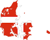
2) MAP AND FLAG:
 |
| SWITZERLAND MAP |
 |
| BERN,SWITZERLAND |
 |
| SWITZERLAND FLAG |
3) BORDER:
Switzerland is located in the Western Part of Europe ; the country is Situated between France to the west , Italy to the south, Germany to the north and Austria and Liechtenstein to the east.
4) MAIN CITIES:
Switzerland is a confederation of states called "cantons"; it includes twenty-six cantons: Aargau (Aargau); Appenzell Ausserrhoden; Appenzell Innerrhoden; Basel-Land (Basel-Land); Basel-Stadt (Basel-Stadt); Bern (Bern); Freiburg (Freiburg); Geneva ; Glarus (Glarus); Graubünden (Graubünden); Jura; Lucerne (Luzern); Neuchâtel; Nidwalden; Obwalden; St. Gallen (Sankt Gallen); Schaffhausen (Schaffhausen); Schwyz; Solothurn (Solothurn); Thurgau (Thurgau); Ticino (Ticino); Uri; Valais (Wallis); Vaud; Zug (Zug) and Zurich (Zürich).
The Switzerland megalopolis is circulated around Zurich which is the most important city and the main economical center of the country. Swiss most developed commercial port is in basel, concentrates the bulk of the region's chemical and pharmaceutical industries, and spreads to other cities such as Lucerne and Winterthur. Geneva, cultural, financial and industrial center, is renowned for its watchmaking and jewelery industry; it is also home to many international organizations. The political capital, Bern, has an administrative and financial vocation. Lausanne is a railway region and a university town as well.
5) RELIEF:
Switzerland having a maximum length from north to south of 222 km and a maximum width from west to east of 349 km, covers an area of 41,287 km². Oriented from south-west to north-east, these two chains are separated by the depression of the Swiss Plateau.
The Swiss Alps include several chains, including the Pennine Alps, home to the highest Swiss summit, Dufour Point (4,634 m), in Monte Rosa and, further south, the Matterhorn, the second highest peak in Switzerland. 4 478 m. The central massifs of the Gotthard bear glaciers, the largest in Europe, the Aletsch, located in the Aare Massif. The Alpine system is in some places cut by deep and winding valleys like the Engadine, to the east.
The Jura, meanwhile, stretches from Dole to Zurich and rises to 1,600 m; much lower than the Alps, it is nevertheless a steep barrier that can be crossed only in rare passages.
Between the Alps and the Jura, the Swiss Plateau (or Middle-Country) extends, from south-west to north-east, from Lake Geneva to Lake Constance, with an average altitude of 395 m and a width of about 50 km.
6) CLIMATE:
Switzerland enjoys a mild climate, mountain type with continental influences. The annual thermal average is 7 ° C (ie 20 ° C in summer, 4 ° C in winter), temperatures decreasing in altitude of about 1.7 ° C every 300 m. Rainfall varies with altitude: in the Swiss Plateau, the annual average is about 915 mm of rain, with higher areas generally receiving much more water.
Snow conditions in Switzerland are uneven; it varies between a few days a year in certain valleys of Ticino and from six to ten months in the Hautes-Alpes. Beyond 2,700 m, the peaks are covered with eternal snow.
The cold north winds, like the north wind, predominate in winter. The foehn, a hot and dry wind from the southeast, blows an average of 34 days a year, significantly softening the climate.
Official Website : http://www.oecd.org/general/governmentofswitzerlandusefullinks.htm
Illustration Credit : Muhammad Sharjeel


7 Comments
Swiss is too beautiful
ReplyDeleteYes really, Thanks..
DeleteGreat work Sharjeel..
ReplyDeleteThank you so much.
DeleteNice blog man
ReplyDeleteThank you so much
DeleteThank you..
ReplyDelete